


🚨 தலைமன்னார் கலங்கரை விளக்கம்
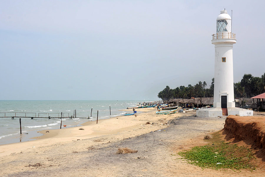
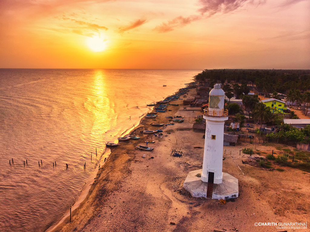
தலைமன்னார் கலங்கரை விளக்கம் என்பது இலங்கையின் வடமேற்கு முனையில் உள்ள மன்னார் தீவின் தலைமன்னார் பகுதியில் அமைந்துள்ள முக்கியமான கடற்கரை கலங்கரை விளக்கமாகும். இது பாக்கு நீரிணை நோக்கி அமைந்துள்ளது மற்றும் இலங்கை–இந்தியா இடையிலான மிக அருகிலுள்ள கடல் எல்லையை குறிக்கும் முக்கிய இடமாகும்.
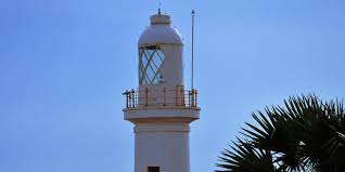
இந்த கலங்கரை விளக்கம் முதலில் பிரித்தானிய காலனித்துவ காலத்தில் நிறுவப்பட்டது. பின்னர் இது பலமுறை புதுப்பிக்கப்பட்டு நவீன கடல் வழிச் செலுத்துதலுக்காக மேம்படுத்தப்பட்டது. தற்போது இது வெள்ளை நிற உருளை வடிவக் கோபுரமாகவும், மேல் பகுதியில் சிவப்பு நிற அடையாளத்துடனும் காணப்படுகிறது.
இதன் ஒளி கடல் வழியாக செல்லும் மீன்பிடி படகுகள், சரக்கு கப்பல்கள் and பிற கடல் வாகனங்களுக்கு பாதுகாப்பான வழிகாட்டுதலை வழங்குகிறது. இது கடல் போக்குவரத்து பாதுகாப்பில் முக்கிய பங்கு வகிக்கிறது.
தலைமன்னார் பகுதி அழகிய கடற்கரை காட்சிகள், ஆழமற்ற நீல நீர் மற்றும் ஆதாம் பாலம் நோக்கிய காட்சிகளால் பிரபலமாக உள்ளது. இதன் வரலாற்று முக்கியத்துவம் பழங்கால மற்றும் காலனித்துவ கடல் வணிக வழித்தடங்களுடன் தொடர்புடையது.
🍃 இன்று, இது ஒரு வழிகாட்டி அமைப்பாக மட்டுமல்லாமல், சுற்றுலா பயணிகள் விரும்பும் அமைதியான மற்றும் அழகிய இடமாகவும் விளங்குகிறது.
🚨 Thalaimannar Lighthouse
The Thalaimannar Lighthouse is a prominent coastal lighthouse located at the northwestern tip of Sri Lanka on Mannar Island. It stands near Thalaimannar Point, facing the Palk Strait and marking one of the closest points between Sri Lanka and India. The lighthouse plays an important role in guiding vessels navigating the busy maritime route between the two countries.
Originally established during the British colonial period, the lighthouse has been rebuilt and maintained over time to support modern navigation. The current structure is a white cylindrical tower with a red top, standing tall against the flat coastal landscape. Its powerful light helps ensure safe passage for fishing boats, cargo ships, and naval vessels traveling through the region.
The surrounding area is known for its scenic beauty, including sandy shores, shallow turquoise waters, and views toward Adam’s Bridge. The lighthouse also holds historical significance due to its strategic location in ancient and colonial maritime trade routes.
🍃 Today, Thalaimannar Lighthouse is not only a functional navigational aid but also a popular tourist attraction. Visitors are drawn to its peaceful environment, photography opportunities, and the symbolic feeling of standing at the edge of Sri Lanka, facing India across the sea.
🚨 තලෙයිමන්නාරම් ප්රදීපාගාරය
තලෙයිමන්නාරම් ප්රදීපාගාරය යනු ශ්රී ලංකාවේ වයඹ දිග අන්තයේ මන්නාරම් දූපතේ තලෙයිමන්නාරම් ප්රදේශයේ පිහිටි ප්රධාන වෙරළබඩ ප්රදීපාගාරයකි. මෙය පාලක් සමුද්ර සන්ධිය දෙසට මුහුණලා ඇති අතර ශ්රී ලංකාව සහ ඉන්දියාව අතර ඉතාම ආසන්න මුහුදු සීමාව සලකුණු කරන ස්ථානයකි.
මෙම ප්රදීපාගාරය මුලින් බ්රිතාන්ය යටත්විජිත සමයේ ස්ථාපිත කර ඇත. පසුව නවීන නාවික ආරක්ෂාව සඳහා එය නවීකරණය කර නඩත්තු කර ඇත. වර්තමානයේ මෙය සුදු පැහැති උස වටකුරු කුළුණක් වන අතර ඉහළින් රතු පැහැති කොටසක් දක්නට ලැබේ.
මෙහි ආලෝකය මඟින් ධීවර බෝට්ටු, භාණ්ඩ ප්රවාහන නැව් සහ අනෙකුත් නාවික යාත්රා සඳහා ආරක්ෂිත මාර්ගය සපයයි. මෙය මුහුදු ගමනාගමන ආරක්ෂාව සඳහා ඉතා වැදගත් වේ.
තලෙයිමන්නාරම් ප්රදේශය අලංකාර වෙරළ තීර, නිල් පැහැති අඩු ගැඹුරු මුහුද සහ ආදම් පාලම දිශාවට දර්ශන සඳහා ප්රසිද්ධය. මෙය ඓතිහාසික වශයෙන්ද වැදගත් වන අතර පැරණි වෙළඳ මාර්ග සමඟ සම්බන්ධ වේ.
🍃 අද දින මෙය නාවික උපකරණයක් ලෙස මෙන්ම සංචාරකයන් ආකර්ෂණය කරන සුවිශේෂී ස්ථානයක්ද වේ.

